| WA8LMF Home Page | PSK63 APRS Page | Main APRS Page | HF APRS Operation | Updated 6 May 2010 |
[This is an XGA 1024x768 pixel screen capture. If you are viewing this on a system with lesser resolution, you will have to scroll right and down to view all parts of the map.]
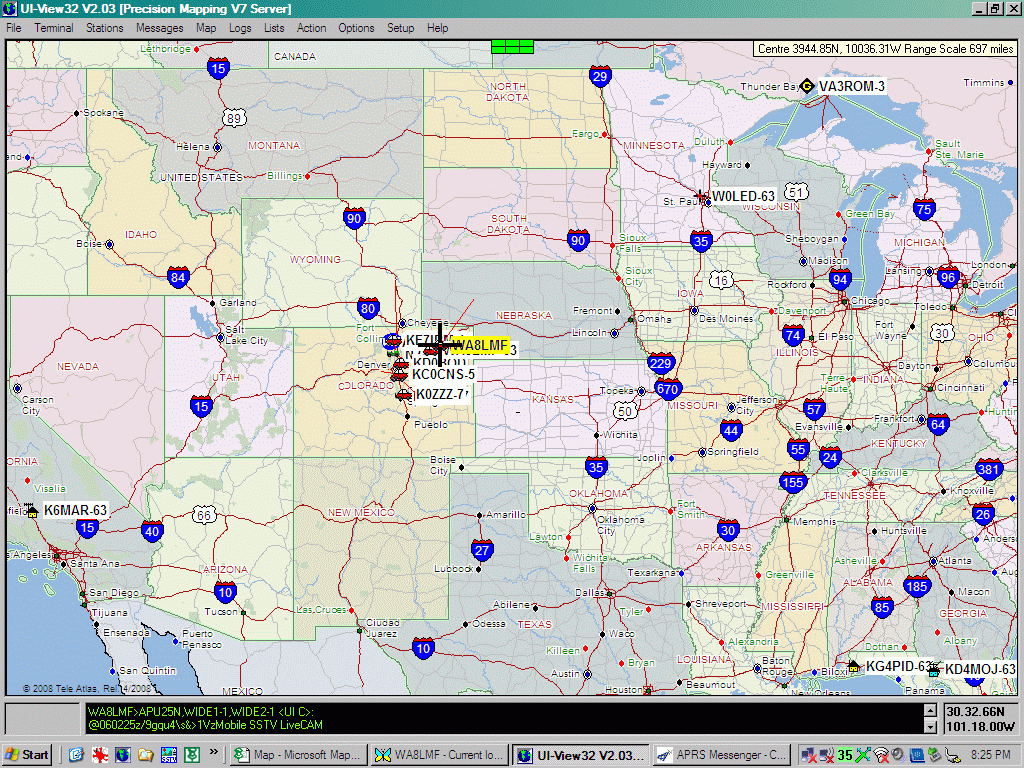
This screen shot of UIview shows normal VHF APRS activity monitored on my Kenwood D700 with UIview, --and-- 30-Meter PSK63 HF activity received on my Yaesu FT-857 with APRS Messenger.
At the time of this screen shot, I was on Interstate 76 about 50 miles east of Denver, CO at about 6 PM local (Mountain Daylight Time) 5 May 2010. I was beaconing simultaneously on 2 meters as "WA8LMF", and on 30 meters HF PSK63 as "WA8LMF-63".
The vertical cluster of stations in Colorado are 2-meter activity up and down the I-25 corridor in the flatlands around Denver, just east of the front range of the Rocky Mountains. The WA8LMF highlighted in yellow marks my location at the time this screen shot was captured. I am on I-76 about half-way between Denver and the Colorado/Nebraska state line.
Just showing under the WA8LMF tag (yellow denoting that it is a UIview station), mostly covered up, is a white tag for WA8LMF-63; my call in the PSK63 APRS Messenger program linked to UIview via TCP/IP localhost. All the other stations outside Colorado were received directly on 30-meter HF . This includes the stations in California, Minnesota, Ontario and Florida