|
WA8LMF Home Page | Main Ham Radio Page | Main Links Page | Updated 15 November 2006 |
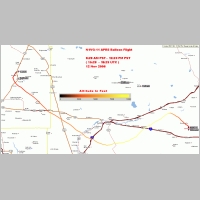
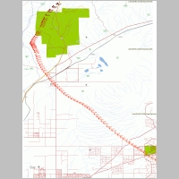
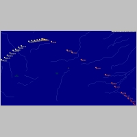
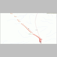
Maps of N1VG-11 Balloon Flight
12 November 2006
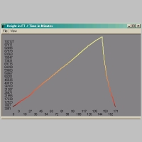
The maps below were created by UI-View32 and the plug-in UI-Height-Track. Data was received both off-the air on 144.39 in Pasadena and via the APRS Internet system.
Click on thumbnails for full-sized image.
|
|
|
|
|
|
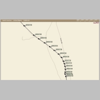
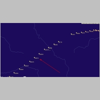
Final Descent And Landing Plotted On APRSpoint |
Created by IrfanView