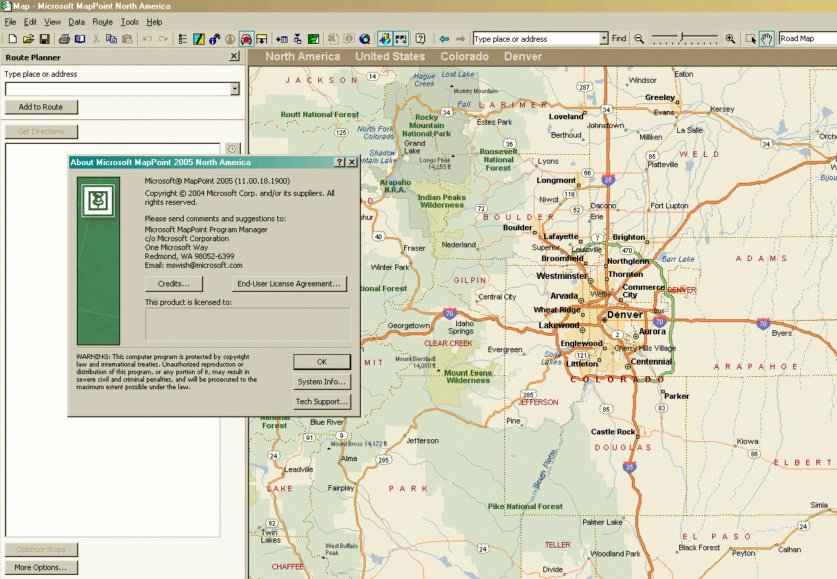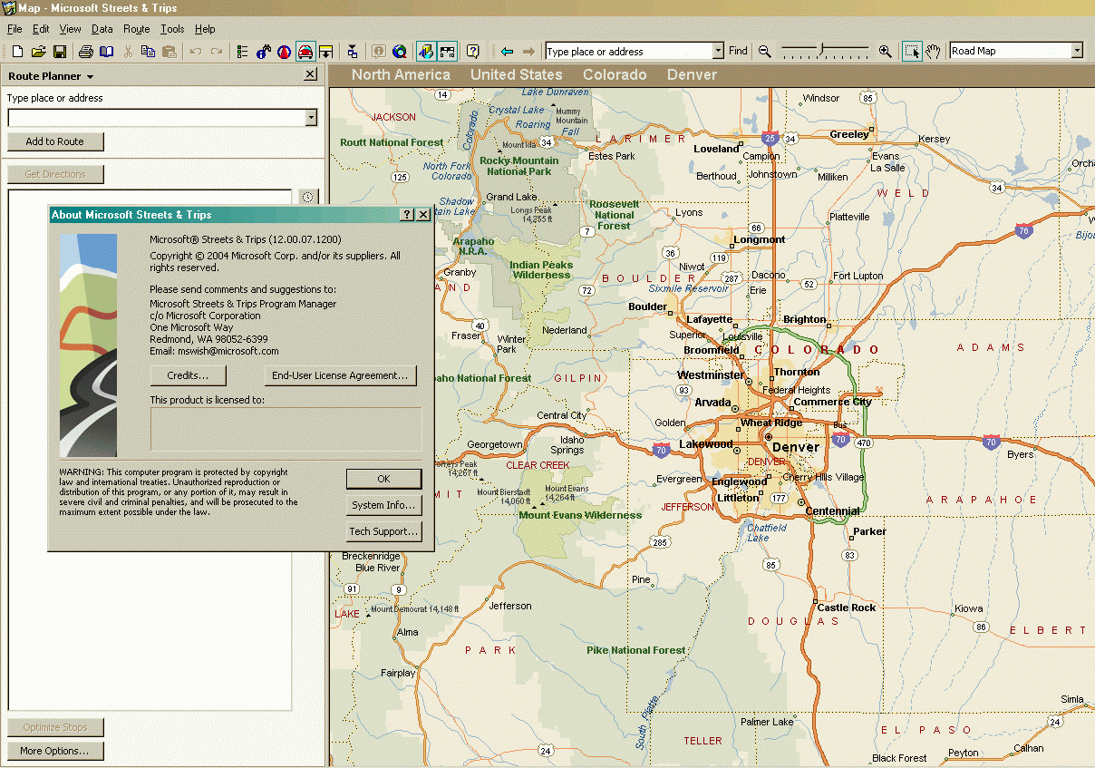
Both these programs are running under Windows 2000 from
the same folder on the hard disk, and are sharing the same database from a 2008
edition of Streets & Trips. Note that MapPoint 2004 is announcing itself as a
non-existent 2005 version, due to the presence of Streets 2005 in the same
folder. Note also that there are a few more buttons in the MapPoint tool bar for
the data analysis functions that don't exist in Streets.
You can tell the road data in this view of the Denver, Colorado metropolitan area is not the original for either program. When both programs were first released, the north-west segment of the green beltway Route 470 (between Broomfield and I-25) had not yet been finished and didn't show. This segment first appeared in both programs in 2006.
NOTE: These are both large GIF images created from screen caps of a 900x1440 WXGA screen. You will have to scroll on lower-resolution displays to see all of each picture.