
See how to use APRS at Field day!
Are you using APRS to its full potential? . See typical oversights in using APRS for real events.
APRS-by-Bob Power Point Download (3 Mb)
APRSdos (lousy maps, but good network analysis views). .
download APRS876.zip (1.4Mb). . See
INSTALL.TXT.
New Initiatives! . Over the last few years there have been several initiatives that have drastically improved APRS network performance and useability for users: Please see these important initiatives for your areas!
OVERVIEW: The Automatic Packet Reporting System was designed to support rapid, reliable exchange of information for local, tactical real-time information, events or nets. The concept, which dates back to the mid 1980's, is that all relevant information is transmitted immediately to everyone in the net and every station captures that information for consistent and standard display to all participants. Information was refreshed redundantly but at a decaying rate so that old information was updated less frequently than new info. Since the primary objective is consistent exchange of information between everyone, APRS established standard formats not only for the transmission of POSITION, STATUS, MESSAGES, and QUERIES, it also establishes guidelines for display so that users of different systems will still see the same consistent information displayed in a consistent manner (independent of the particular display or maping system in use). See the original APRS.TXT.
THE GOAL IS COMMUNICATIONS and LOCAL INFO UPDATE, -NOT- JUST VEHICLE TRACKING!
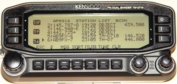
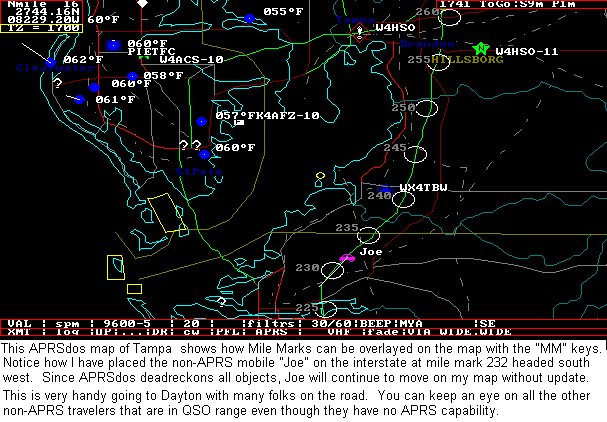
APRS was never intended to be just a vehicle tracking system (GPS was added in the 1992 time frame when GPS became affordable). APRS is much more. See the Kenwood mobile display above. This is the STATION LIST which shows the nearest 100 stations heard. . In this case, not only are the two stations of AB9FX nearby, but also his current VOICE operating frequency is visible. Also, we can see that this radio is in OPERATING range of three voice repeaters that are also identifying themselves as objects on APRS as the locally recommended voice operating channels.
APRS provides situational awareness to all operators of everything that is going on in his local area, whether it be Weather reporting, traveler info, Direction Finding, objects pointing to ECHOlink and IRLP, or Traffic reporting and emergency response. All of this while providing not only instantaneous operator-to-operator keyboard messaging capability for special events, but also an always-on Voice Alert backchannel between mobiles in simplex range. There is even an APRS interface to the WinLINK system called APRSlink, so that mobiles can send and receive Email without needing a PC. Think of APRS as a signalling channel to reveal ALL amateur radio resources and live activities that are in range of the operator at any instant in time.
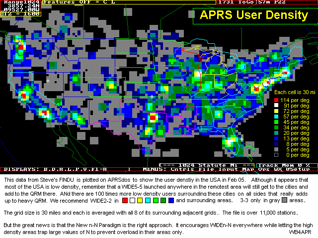
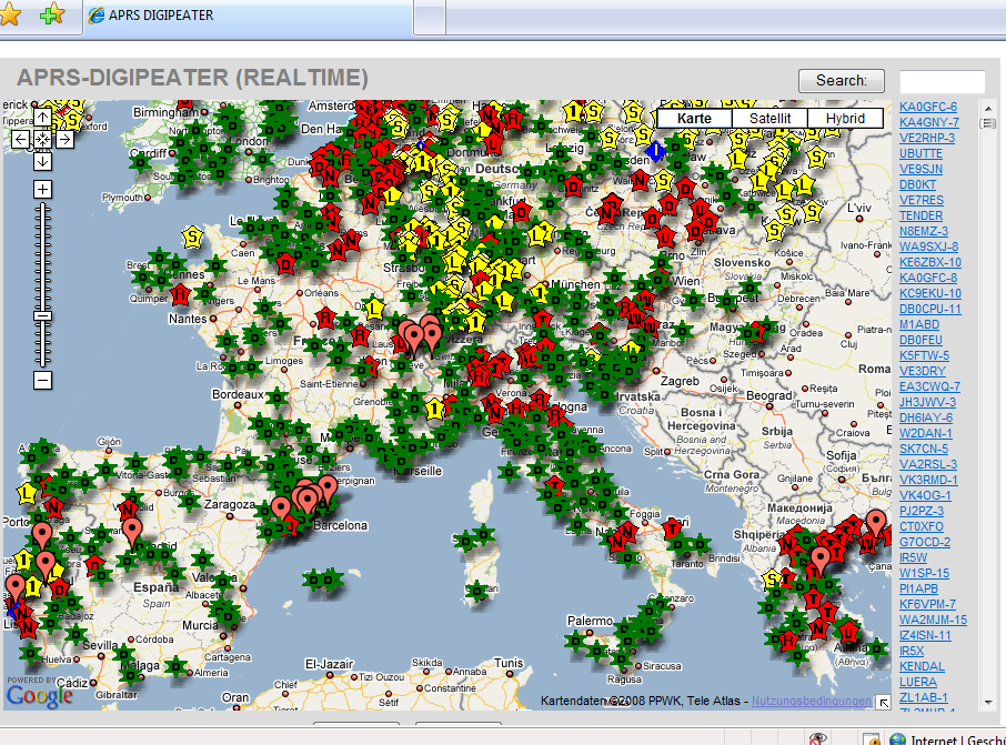
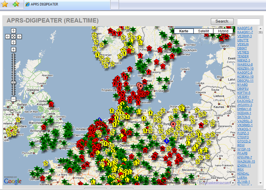
UBIQUITOUS OPERATIONS: Consistent with providing information on all resources within range, APRS must also work across all boundaries and in all areas of the continent for all travelers. For this reason, 144.39 MHz is dedicated to APRS throughout North America. Other continents have similar single frequencies such as 144.80 in Europe and 145.175 In Australia. Also after 14 years of evolution, APRS was greatly simplified beginning in the 2004 time frame to eliminate obsolete and inefficient routing. See the New-N Paradigm. Now, there is only one recommended PATH everywhere, and it is VIA WIDEn-N for fixed stations where N is usually 2 in most metropolitan areas and no more than 3 most everywhere else. Mobiles can use VIA WIDE1-1,WIDE2-1 in those 2 hop areas to gain help from nearby WIDE1-1 fill-in digipeaters. See the high density areas in the map below:
APRS GLOBAL INTERNET SYSTEM: Although APRS is a local, tactical real-time two-way communications system, the enormous free bandwidth of the Internet was added in the mid 1990's to allow global monitoring of all real-time data from all local communities around the world. Everything on any APRS frequency is being monitored locally and fed globally into the APRS internet system by hundreds of Igates See live list (complete) or a Map of I-G symbols. Not only does this allow for global monitoring of any local activity, it also allows two-way point-to-point messaging between any two APRS users anywhere on the planet (that has an APRS infrastructure). Think of it as everything goes in so it is availabe to everyone, but the only thing that comes from the internet back to local RF are messages and selected position data requested locally.
RECENT UPDATES: This web page is the primary APRS resource for all things APRS. It attempts to keep all users up-to-date with the latest information on system operation. New topics include:
APRS was developed by Bob Bruninga, WB4APR, as a real-time local tactical communications system for rapidly exchanging digital data of immediate value to operations. This really took off when GPS became available and MAPS were integrated into the system for tactical situational awareness of everything in the net. In the 13 years since its introduction, (see history) it has grown to encompass just about every aspect of Amateur Radio. For an introduction to APRS, CLICK HERE or check out the first category of links below to get the big picture of what APRS is all about...
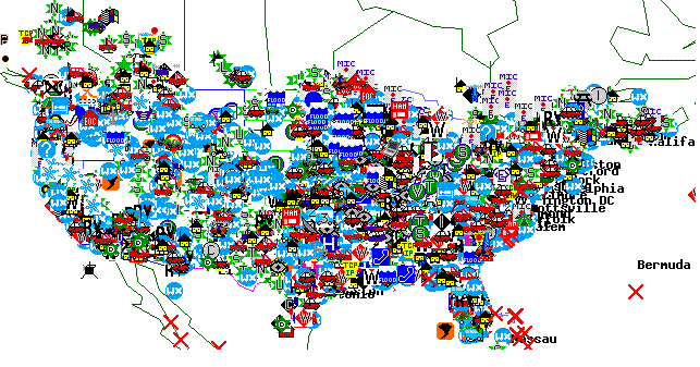
The above shot was APRSdos in the early 1990's. Now it is world wide linked by K4HG's global FINDU.COM internet links. The map below shows the approximate 20,000 users now on the air in the USA. Or Click here to see the entire 30,000 worldwide users LIVE.
 (Refresh)
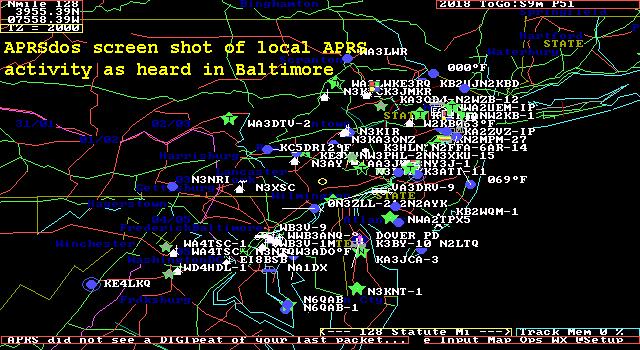
Here are some other LIVE maps from around the country and the world showing the global, yet LIVE aspect of APRS:
USA WEST:........
Southwest,
Northwest,
4-Corners,
Central CA,
Southern CA,
Hawaii
USA CENTRAL:
North Central,
Midwest,
South Centeral
USA EAST:........
New England,
Northeast,
Mid Atlantic,
Wash-DC,
Southeast,
Florida
WORLD:............
Europe,
S.America and Africa,
Australia/NewZealand,
Japan
APRS-IS, the APRS Internet System: The APRS-IS is a worldwide network of internet gateways that provides end-to-end RF connectivity from any where on the globe within range of an IGate. In addition K4HG maintains FINDU.com which maintains a database of all packets heard anywhere at any time, up to the minute. For the live status of the APRS-IS, see this table.
The remainder of this page is just a list of links to just about everything
involving APRS in the last 10 years. To cover the breadth and
depth of these applications, just follow the links...
OVERALL APRS CONCEPT LINKS FOR NEW USERS:
NEW ITEMS and IDEAS
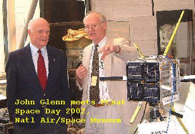
APRS SATELLITE PROJECTS
OTHER APRS APPLICATIONS AND USES
OTHER LIVE INTERNET APRS SITES
OTHER APRS INFORMATION SITES
APRS DATA and FILES
HISTORICAL LINKS AND OLD STUFF
Join the TAPR APRS Special Interest Group E-mail Reflector:
APRSSIG
You are visitor number: The Naval Academy is a registered user of APRS.
The purpose of this web page is to show several applications
currently in use at this site and should not be considered as an advertisement
or an endorsement of any commercial product.
WA8LMF Mirror of WB4APR Website - 21 July 2008
Back To Satellite Ground Station
Since 24 Sept 2001. (averages about 38,000 a year sinec April 98)..