Update:
|
||||
|
|
|
||
| WA8LMF Home Page | Main Ham Radio Page | Main Links Page | Updated 16 March 2014 |
Links To Locations Lower Down On This Page.
Microsoft publishes 4 very similar-looking desktop mapping products.
For North America:
- Streets & Trips
- MapPoint North America
For Europe:
- AutoRoute
- MapPoint Europe
All versions show a simple outline map of the world when zoomed and scrolled outside of their target coverage areas. National borders show along with a surprisingly large number of cities shown as point objects, but no road detail or internal subdivisions such as provinces, parishes, counties, states, etc.
Streets & Trips and Autoroute are consumer versions of these programs and sell typically for USD $30-$40. The two versions of MapPoint are considered business-oriented programs (they integrate themselves with Microsoft Office when installed), and sell for USD $250-300. MapPoint contains numerous data import and analysis tools not present in Streets or Autoroute. MapPoint is designed to communicate with other programs while Streets/Autoroute can't. New versions of MapPoint and Streets/Autoroute are released, with updated road and points-of-interest data, each year. In the past, MapPoint was only updated every two or three years.
(In the past, MapPoint was updated on the even-numbered years only. However, the 2008 cover date was skipped and a "MapPoint 2009" released in late August/early September 2008. MapPoint 2010 was released in September 2009. MapPoint seems to now be on an every-year update schedule just like Streets/AutoRoute)
Update:
|
||||
|
|
|
||
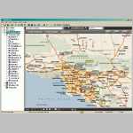
On-screen, the programs look nearly identical. (Click Here for comparative
screen shots of Streets & Trips and MapPoint. Opens in new window.) All the programs have the
same basic drawing and annotation tools that allow you to mark up maps with
lines, circles, boxes, text notes, highlighted routes, etc. (It's actually the
same drawing toolbar that appears in MS Word or Excel.) Annoyingly, the overlay
files these markups (and any plotted points) are saved into are different for
each version of the programs, even though the contents are essentially the same.
Streets & Trips saves into files with the extension
.est.
Autoroute saves into files with the extension .axe.
Both versions of MapPoint save into files with the extension
.ptm . The internal format of these
files change with every new version of each program; i.e. you can't open an
overlay file in a version of the program older than the one that created it.
(You can read older overlays in newer versions of each program, but you
can't save any changes back to the older formats.) Streets and
Autoroute can't open overlay files created in MapPoint. MapPoint can
read overlay files from Streets or Autoroute, but it can only save
changes into it's current version of .ptm .
Thus for overlay file exchange purposes, an old version of Streets/Autoroute
produces universally-readable overlay files. A new version of MapPoint is
a universal recipient.
Although the data is stored in incompatible files, the data (draw objects,
recorded GPS tracks, etc) itself is transferable via the Windows Clipboard. If
both Streets/Autoroute and MapPoint are installed on the same computer, you can
start both programs at the same time. You can then copy from one program ("Edit,
Copy" or Ctrl-C) and paste ("Edit,Paste" or Ctrl-V) to the other. All objects
automatically place themselves in exactly the same position on the receiving
program.
You can import simple files (Excel spreadsheets or comma-delimited text files)
containing lists of addresses or lat/long coordinate pairs into any of these
programs. Note that plotting street addresses (a.k.a "geocoding"
data) will only be approximate. These mapping programs don't actually know the
exact location of each street address. Rather, the internal database only has
the beginning and ending address numbers on each side of a "street segment"
(typically a city block, sometimes several city blocks, or even several
miles/kilometers in rural areas). They then interpolate where a given address
"should be" based on the known start and end addresses of the segment. Quite
often, street-address-based geocoding will produce an error of a block or more
if the house numbering isn't linear and consistent. These same
issues apply to the millions of "points-of-interest" (gas stations,
hotels/motels, restaurants, etc) addresses provided with these programs. It's
sometimes a bit of a "treasure hunt" locating places shown on the map when you
arrive in a strange city, when they may be off by a block or more.
On the other hand, GPS-generated lat/long coordinates plot very precisely, as
long as the GPS is set to the default WGS84 datum that all the maps in these
programs are based on.
In Streets/Autoroute, imported data points become simple generic identical
"pushpin" symbols. MapPoint provides multiple ways for external data to be
imported, analyzed, and displayed on top of it's maps. In MapPoint, the size,
color or symbol type can be varied based on the values in other fields of the
list being read; i.e. it does "thematic mapping". For example, you can place
house icons on the map based on address, and then color-code them (or vary the
size) based on the selling price. Once plotted, MapPoint allows you to select
groups of plotted objects based on state, county or postal district lines, or
arbitrarily-drawn "regions". For example, you could plot the sales of
individual stores in several counties by varying the the size of the individual
icons based on sales volume. You could then color-code county-area overlays
based on the total sales volume of all the stores inside that particular county.
Further, MapPoint has an extensive API (Applications Programming Interface) that
allows external programs to pass data directly to MapPoint in real time via
Windows DDE (Dynamic Data Exchange), and to command MapPoint to draw/plot it in
various ways. It is this API that allows outside (non-Microsoft) developers to
create custom applications for MapPoint such as vehicle location systems, 911
answering point displays, WiFi-hotspot survey systems, etc. Such applications
can either show up as separate applications, or appear as plug-ins (i.e. new
menu pull-downs) inside of MapPoint. In this respect, MapPoint is similar to
Microsoft Word and Excel. The programming interfaces and macro languages of
these two programs have created an entire industry of third-party developers
writing add-ons, scripts and plug-ins.
Despite the huge difference in program features between MapPoint and the lesser Streets/Autoroute, and year to year feature changes, the underlying map database structure in MapPoint (both areas, Streets & Trips (North America) and AutoRoute (Europe) has remained the same. You can use the data files from either a recent version of MapPoint, or a recent version of the inexpensive Streets&Trips/Autoroute to update older versions of either MapPoint or older versions of Streets/Autoroute).
| IMPORTANT: As of the 2012 edition of MapPoint, the update procedure described below no longer works. The MapPoint, AutoRoute and Streets & Trips databases have changed format, and are no longer compatible with earlier year editions of MapPoint. |
|
To perform the update:
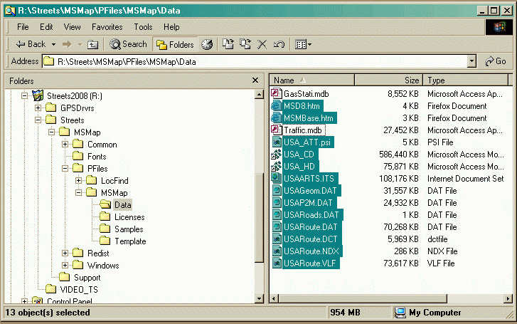
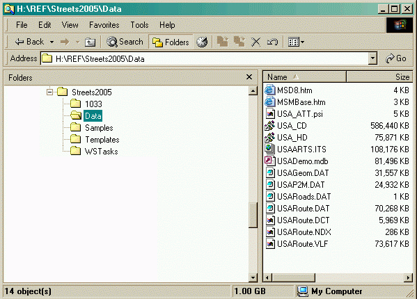
- Copy the entire contents of your existing older install CD or DVD to a folder on your hard drive.
- Copy the entire contents of the /DATA folder from the new Autoroute or Streets & Trips CD or DVD.
- Paste these contents into the /DATA folder of the hard disk copy of your MapPoint install CD, overwriting the existing files when prompted.
- Burn a new CD from the updated hard disk copy. The result will be, for example, that a 2006 MapPoint installer can now cold-install setups with the 2006 program and 2009 data!
Streets, Autoroute and MapPoint each copy over a gigabyte of program files and data to your hard disk when installed completely on the hard disk. (An install option is to leave about 700 MB of data on the CD/DVD. This then requires that the data disk be in the drive when using the program.)
Streets or Autoroute, and it's corresponding area MapPoint are so similar that they can be installed into the same folder so that they can share one copy of the database and some of the supporting program components. Installed this way, the two programs occupy a total of about 1.3GB hard disk space instead of over 2.2 GB for normal individual installs.
To do a combined program install, one should preferably use a copy of Streets or Autoroute and MapPoint from the same year. For example, Streets 2004 and MapPoint North America 2004, or Autoroute 2006 and MapPoint Europe 2006. Some combinations of different years will work; one of my installations uses Streets 2005 and MapPoint 2004.
Install Streets or Autoroute first. Opt for a custom install and name the install folder "StreetsPoint" for North America or "RoutePoint" for Europe. Then run the MapPoint install, opt again for a custom install, and install into the same folder.
Once the combined install is completed, the latest data from a copy of Streets or Autoroute each year will now update both programs at once! The only side effect of the combined install that I can detect is that the construction data updates that download current highway department construction zones (so the Route Planner feature can route around construction delays) no longer works in some configurations.
MapPoint (but not Streets or Autoroute) is usable
directly by least three amateur radio APRS applicatons.
Because
Streets & Trips and Autoroute lack the software interface required for external
programs to talk to them (that MapPoint has), they can not be used directly by any APRS program.
Streets (or Autoroute) is only useful for
updating the database of MapPoint as described above, or as a source of screen
captures of static (fixed non-zooming non-scrolling) maps for use with other
programs.
| Note: As of release 4.53 in March 2009, APRSpoint now supports the standard symbol set, with a limited number of overlay characters, for display on incoming transmissions. However, you cannot select most of these to transmit as your own symbol. |
|
Important! MapPoint 2009 has some severe
drawbacks for use with APRSpoint, compared with previous versions.
Due to the severely reduced MapPoint push-pin symbol set in MapPoint
2009, discussed above (click here),
all APRS stations (home stations, mobiles, digipeaters, WX stations,
etc) now appear as identical generic maroon pushpins in versions of
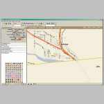
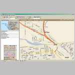
APRSpoint before 45.3. Click on the two
thumbnails below for comparisons of pre-4.5.x versions of APRSpoint running in MapPoint
2006 and 2009. |
||||
|
|
APRSpoint with MapPoint 2006 |
|
APRSpoint with MapPoint 2009 |
|
Note: The APRS standard provides for overlaying a single letter or number on top of the basic APRS symbol (a.ka. "icon") These overlay characters are used, for example, to distinguish home WIDE1-1 fill-in digipeaters (number "1"overlaid on the digi star symbol) from wide-area digipeaters (letter "N" for WIDEn-N overlaid on the star symbol). They are also used for distinguishing Echolink ("E"), IRLP ("I") and Winlink ("W") nodes by overlaying the generic black diamond "node" symbol. Without the overlays, half the information about the object on the map is being lost.
More details on the standard APRS symbol set and the overlay technique are here on this website.